Fire evacuation maps are critical safety features for any facility. An accurate, up-to-date fire exit map protects people and prevents liability in schools, manufacturing, healthcare, offices, and apartments and condos.
But just as all buildings are not made the same, neither are fire evacuation maps. It’s important to know the differences — and to avoid common mistakes in creating or updating a fire exit map. With extensive experience across every sector, Building Maps knows the code requirements, best practices and mistakes to avoid for every kind of facility.
What do building evacuation maps have in common?
Fire evacuation maps are simplified building schematics that guide people away from an imminent threat or hazardous area. More than a code requirement, they are essential for the safety of everyone who enters a building.
But even where not required by code, maps are always smart: The U.S. Fire Administration estimates the country suffered 110,000 nonresidential fires in 2023, leading to 130 deaths, 1,200 injuries and $3.2 billion in economic losses.
Accurate, well-designed maps help prevent those kinds of human and property losses. They can serve a tool for fire drills to confirm everyone is following the safest egress routes. And they can be shared with local fire departments for emergency planning.
Evacuation maps must be simple and easy to understand. Common features include:
- Primary and secondary egress routes
- Building exits
- “You Are Here” location
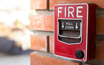
- Fire pull locations
- Fire extinguisher locations
- Clear map legend
- Automated external defibrillator (AED) Locations
What are differences for specific facilities?
Based on Building Maps’ experience creating thousands of safe, compliant maps for organizations of every size and complexity across the U.S., here is an overview of some sector-specific considerations:
Schools
School fire evacuation maps must include easy-to-read floor plans with a “you are here” marker. Other features will vary depending on the building, state requirements and local fire codes, but can include fire exit doors, primary and secondary egress routes, fire pull locations, labeled stairwells, AED locations, and severe weather shelter locations.
Evacuation maps should be posted next to the door in every classroom, at stairwells and elevators, and in spaces used by visitors, such as public events and visiting sports teams.
Manufacturers
In addition to complying with local fire codes, manufacturers must include fire evacuation maps to meet emergency planning requirements of the Occupational Safety and Health Administration and follow the pre-incident planning standards of the National Fire Protection Association (NFPA).
In addition to color-coded escape routes, maps may include fire exit doors, primary and secondary egress routes, location of safety equipment, stairwells, mechanicals, and shutoffs. All stairwells and elevators should have clear evacuation maps posted. It’s also a good idea to post maps on bulletin boards in meeting spaces, and in areas where the exits are not obvious.
Offices
Fire evacuation maps are often required by fire code, OSHA code, federal, state, and municipal codes. Regardless of requirements, maps are important for the safety of employees as well as visitors. Maps should be posted near all stairwells and elevators, in all conference rooms and high-visibility areas such as doorways and bulletin boards. Even when employees are familiar with the building, they may not understand which exit is the closest, so maps should show where exits are not obvious.
These considerations are important for shared office space: Under OSHA and NFPA regulations, property owners and landlords are responsible for building evacuation maps in shared or public areas like lobbies, staircases, and hallways.
Apartments and Condos
Maps are an important part of planning for and responding to emergencies in multi-unit buildings with multiple residents. These maps must be customized for each location while meeting various regulatory requirements and local fire codes.
Without proper signage, property owners or landlords risk being liable for any injuries or deaths related to fires and other emergencies. In addition to proper signage, risk assessment and planning is one of the best ways to prepare for and respond to fire evacuation, severe weather, or security threats before they happen.
No matter what sector the building serves, an effective evacuation map also must consider the size, design, location, age, function and other factors. The safety experts at Building Maps are trained and equipped to design customized maps for any setting.
Three common fire-exit map mistakes — and how to avoid them
Trying to do it yourself
Complex requirements, including various local and state fire codes, make it very difficult to create code-compliant maps, even with online DIY tools. The experts at Building Maps, on the other hand, are more than skilled illustrators: they study fire codes and safety practices to create effective, code-compliant maps.
Failing to update maps
Original floor plans are useful when a building is built. But as time goes by, fire evacuation plans can become obsolete by an action as simple as relocating a fire extinguisher. A map that fails to note a new partition or doorway can add confusion in an emergency and put lives at risk. Building Maps makes it easy to update evacuation plans using our expertise and state-of-the-art technology.
Thinking updating the map was someone else’s job
Fire evacuation maps often get neglected or fall out of date when no one knew who was responsible. That does not absolve the organization from liability.
The easy solution
Contact Building Maps.
Our advanced reality capture quickly maps your building and surveys your emergency assets.