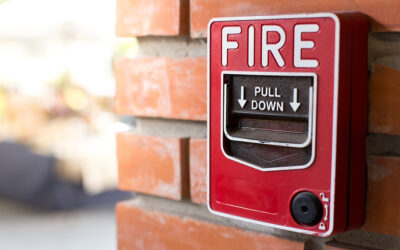
Once a tornado warning is issued, anyone in its path has 10 or 15 minutes to take cover. Winds can reach 300 mph, tossing cars into the air, leveling buildings, and turning debris into deadly projectiles. Everything happens so fast, it will test any action plan for disaster preparedness.
Despite their almost unimaginable power, tornadoes are not the deadliest type of severe weather in the United States. That distinction belongs to floods, which kill an average of 125 people every year.
The arrival of spring opens a seasonal increased risk for these and other types of severe weather, serving as a reminder that severe weather plans can help prevent tragic injuries or loss of life.
SHELTERS ONLY WORK IF PEOPLE CAN FIND THEM
Businesses, schools, and other facilities often have designated storm shelters. But not all shelters are built the same. Case in point: A basement tornado shelter is the last place you want to be during a flash flood.
And even the ideal shelter is worthless if people can’t find it in time. Visitors might not know a shelter exists, or how to evacuate the building. Severe weather maps showing clear directions to the nearest shelter or safest exit are critical to every building emergency action plan.
When the clock starts ticking in severe weather, panic can take hold. That’s why it’s important that weather maps:
- Are easy to read, with widely recognized symbols
- Are posted in useful, high-visibility places
- Show paths to follow to shelter
- Leave no room for misinterpretation
Don’t overlook the need to clearly identify the shelter space itself, especially for people unfamiliar with your building, with a sign at the entrance. And in some situations, the best option is to leave the building, so include an emergency evacuation map.
DIFFERENT WAYS TO WEATHER THE STORMS
Tornadoes have been recorded in every state, but they are not the only type of fast-moving severe weather. Floods can become deadly in minutes. Thunderstorms can spawn tornadoes and other damaging winds, lightning and hail. Hurricanes can combine all of these, along with the added risk of storm surges and large battering waves.
An action plan for disaster preparedness — including designating space for shelter — needs to consider the different natures of all types of severe weather.
Tornadoes and high winds: Enclosed, windowless areas in the center of the building, at the lowest level possible, are preferred. Avoid using elevators to access the space. Interior stairwells can serve as shelter.
Thunderstorms, lightning and hail: Direct people to shelter indoors — open-air structures like picnic shelters offer no protection from lightning. Keep windows shut and stay away from them. If flooding is not a risk, the interior, low-level spaces like those used for tornado shelters are a good option. (Note that concrete may contain wire mesh that could conduct electricity during a lightning strike, so avoid leaning against concrete walls and lying down on concrete floors during the storm.)
Hurricanes: Evacuation is preferred. If it’s too late to evacuate, a small, enclosed room with no windows can provide shelter. However, hurricanes often bring flooding, so avoid lower-level rooms. A ground-floor shelter with nearby stairwell access can be the best choice.
Floods: Evacuation is preferred. An alternative if it is too late to leave is moving to a higher level of the building or even the roof — but never to an enclosed attic space.
A SIMPLE SOLUTION FOR COMPLEX CHALLENGES
These are just a few of the severe weather incidents that can put people at risk, especially in spring and summer. Other dangers at other times of the year can range from extreme heat to dangerous winter weather. They can include more geographic-specific disasters like wildfires, dust storms, and earthquakes.
At Building Maps, we have worked to mitigate these risks and more in every part of the country, for every type of building from apartments to schools to hospitals to offices and factories. Our teams are more than designers or illustrators — we are experts trained in building safety.
We understand the diverse risks and appropriate response — such as sheltering vs. evacuating — to severe weather. We can help any organization create maps that are key to an effective action plan for disaster preparedness.
Weather can be unpredictable, but you can always count on Building Maps. Contact us today by phone or email.
Or tell us a little bit about your project to request a quick and free quote.