Building and campus maps can serve a variety of functions, with varying features, depending on the specified need. Whereas wayfinding maps are instrumental in everyday direction, safety maps are a critical component of any school’s Emergency Operations Plan and should be regularly reviewed and updated to protect students and staff. How do you know which emergencies to prepare for, though? And what information should be included? Let’s take a look at the typical maps used for school safety planning.
Fire Maps
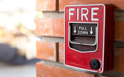
Fire evacuation maps favor simplicity over excessive detail, as they need to be easy to follow in case of an emergency. They should depict clearly marked, safe egress routes, all exit doors and stairwells, the location of safety equipment such as fire extinguishers, fire pull locations, and first aid, as well as a “You Are Here” location. Used in conjunction with regular evacuation drills, fire evacuation maps aid students and faculty in making a safe and timely exit when every minute counts.

Security Maps
Security maps offer a higher degree of detail, as campus staff utilize them in the preparation for and response to security threats. These accurate floor plans are essential tools in an emergency, assisting with evacuation guidance, lockdown implementation, and leading emergency personnel through a building. They will likely feature labeled hallways and stairwells, exit and entry locations, alarm control panels, camera locations, and utility shut-offs, with clear instructions on how to properly respond to a security threat.

Severe Weather Maps
When it comes to natural emergencies, time isn’t always on your side. Severe weather maps are presented in a simplified form, including important building features such as rooms, doors, exits, hallways, and stairwells. They depict optimal shelter-in-place locations and emergency instructions in the event of tornadoes, hurricanes, storms, flooding, and more, providing guidance to teachers and students, no matter what Mother Nature throws at them.

Assembly/Reunification Maps
Due to their function, assembly and reunification maps may focus on the school campus as a whole, as well as the surrounding areas. These maps are concerned with relocation to a safe, external location, helping to facilitate accurate headcounts and reunification with loved ones. Reunification maps, in particular, tend to include a family staging area, a student staging area, and a reunification area, clearly illustrating each in order to make the process as smooth as possible.

Tabbed Map Holders
With so many scenarios to plan for, it’s imperative for necessary information to be easily accessible, without wasting time digging through desk drawers and filing cabinets. Tabbed safety maps and acrylic holders are an excellent organizational option, as each customized map can be removed in an emergency, keeping this crucial information right at your fingertips when you need it most.

Safety Mapping Experts You Can Count On
While planning for every major emergency can feel like a daunting task, not every step has to be a chore. Here at Building Maps, our team of safety experts and professional illustrators knows what it takes to create reliable, code-compliant maps to help you prepare for the unexpected. Be sure to reach out if you have questions, or contact us today for a quick and free quote.