Safety in schools is a consistent topic of discussion. It seems like every other week, there’s another story in the news reminding us how vital it is for schools to prepare for a variety of situations. When considering the biggest threats to a school environment, the “Big Three” concerns are Security, Fire, and Severe Weather. Each threat comes with its own challenges that should be addressed in a school’s Emergency Operations Plan (EOP), but approaches to handling them should all feature one key component, the safety map.
School Safety Map Features: Egress Routes and Shelters
Although making school safety maps requires careful planning, they all share a common goal—guiding students, staff, and visitors to safety. The route may be different depending on the emergency.
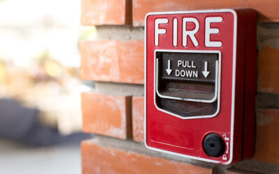
In case of a fire, an evacuation map must clearly depict how to egress out of a building. In addition to clearly marked primary and secondary egress routes, the map should also feature a “you are here” location, all exit doors and stairwells, fire extinguishers, fire pulls, first aid, and an assembly area for occupants. There may be additional requirements depending on your local fire code.
During security or severe weather threats, safety maps must illustrate how and where to shelter in place or lockdown. Severe weather maps may guide students and staff to either a general sheltering location or one specific to each class. Classrooms may also have their own specific egress route to prevent overcrowding of doors and hallways. Security maps should clearly convey instructions on what to do during a threat, saving precious time in the midst of a crisis.
Don’t Forget to Update Your Safety Maps
While many schools do address security, fire, and severe weather concerns with their safety maps, most have difficulty in maintaining maps over time. Often this is because the person responsible for updating maps will transition to another position, leaving this vital role vacant.
We discussed the importance of a user-friendly, code-compliant evacuation map in our previous post Why Outsource Your Building’s Safety Mapping, which addresses this same scenario of the employee in charge leaving the organization. Employee turnover can cause disruptions to safety map maintenance, allowing for outdated information in the midst of changes such as building renovations. And once your safety maps fall out of date, your EOP becomes unsafe and possibly non-compliant.
Your Safety Mapping Experts
With the increased focus on school safety, it’s imperative to know that your safety strategy is up to date. Unfortunately, a DIY “school map maker” template or software program is not trained in life safety or fire codes. With over a decade of experience, our team of safety experts and professional illustrators is dedicated to creating safe, code-compliant maps that are easy to follow in any emergency.
We collaborate with school districts of all sizes to create and maintain maps that protect your students and staff from fire, severe weather, security threats, and more. Contact our team of experts today so we can help you with your safety plan, because “it’s not just a map, it’s about saving lives.”