An emergency evacuation plan usually starts with a building blueprint. That will be accurate when a building is first constructed — but many plans become outdated.
Additions, renovations, partitions, and even relocated fire extinguishers are just some of the changes that can wreak havoc on a safety map.
To serve its life-saving function of guiding people to safety, a building evacuation map must be accurate. Unfortunately, many schools, offices, apartments, and factories lack up-to-date floor plans, which means their fire evacuation maps are obsolete, too.
The good news: Building Maps has a solution.
Our on-site services deploy cutting-edge technological tools for precise, highly detailed scans of every inch of your building, which we use to create updated, accurate maps.
Millions of data points detect what an old floor plan misses
To create a comprehensive map of a building, our safety experts can deploy two types of technology during on-site walk-throughs.
One device uses LiDAR (an acronym for laser detection and ranging) to scan the building, capturing thousands of points per second, to create a “point cloud,” made up of millions and millions of dots. Those dots form the basis for an updated floor plan.
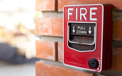
The other device uses photogrammetry with a 360-degree camera to take many hundreds of photos to create an accurate, updated record of the building. This process is especially useful for mapping safety assets such as fire extinguishers and alarms.
What to know for successful onsite services
- The building should not be occupied at the time of a scan. People walking through will disrupt the process.
- We can map every safety asset — but only if they are clearly visible. For example, if a fire extinguisher is blocked from view by a coat rack or behind a closet door, the scan can’t capture it. Our team is detail-oriented and will work with you to make sure these assets are visible.
- If your business or building restricts photography, that will prevent use of photogrammetry. We can look at other options to meet your needs.
- While scanning technology can be used to update an existing emergency evacuation floor plan, it also can be used to create a map from scratch. We’ll help you find the right solution for your needs.
Expertise that makes a difference
Depending on the size and complexity of the building, the process can take as little as a couple of hours or as long as a couple of days.
But the scans are just the beginning. The information gets turned over to Building Maps’ team of expert illustrators who convert the raw data into a standard floor plan — and then the work of developing the safety map begins.
Every project manager and illustrator at Building Maps is trained in life safety code and fire code. They know how to identify primary and secondary egress routes to create an accurate, up-to-date fire escape floor plan. They know how people read fire evacuation maps and security maps in times of emergency.
And they know how to create a map that not only is compliant, but a useful and attractive document to hang on the wall and include in an emergency operations plan.
Building Maps has experience working in education, manufacturing, offices, apartments and health care — buildings of every size and across every sector. Our on-site services team works across the country, combining expertise and advanced technology to deliver comprehensive, up-to-date and accurate building evacuation maps.
It starts with a conversation
Whether you’re unsure about the status of your emergency evacuation floor plan, or already know what you need, reach out for a conversation. We’ll talk about options that work for your project and timeline.
Contact us today by phone or email. Or use this simple form to tell us a little bit about your project to request a quick and free quote.