Security Maps & Critical Incident Maps
What are Security Maps?
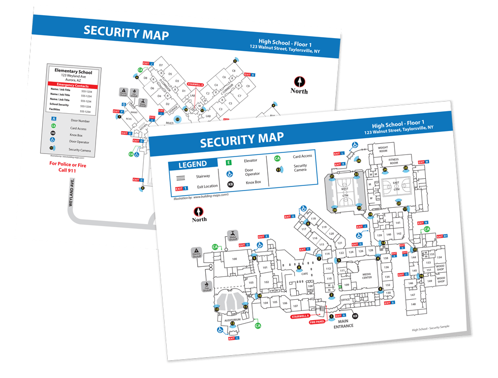
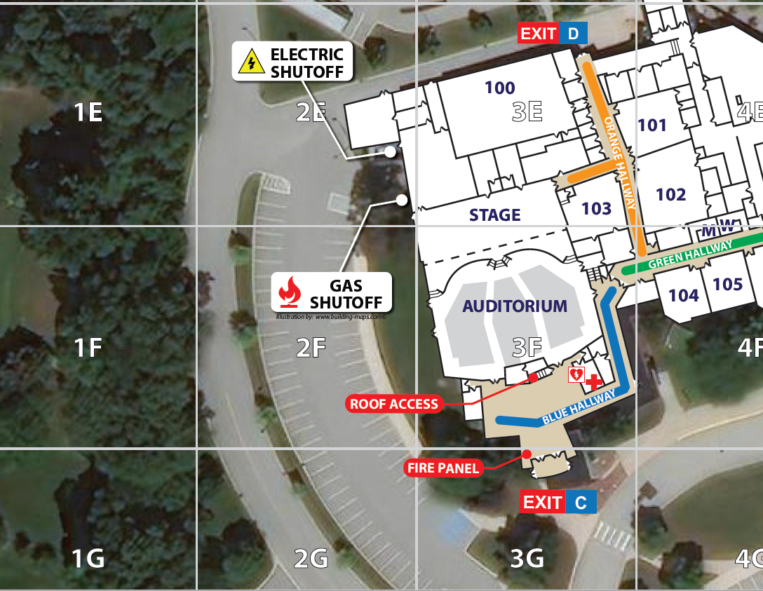
Security maps are highly detailed maps used by first responders and safety personnel to prepare for and respond to emergency situations. A critical incident map includes a numbered and lettered grid overlaid on a satellite image to help first responders coordinate their efforts during an emergency. With a higher degree of detail than standard floor plans, security maps are a valuable tool for training security personnel, planning events, and quickly responding to emergencies.
Who Will Use a Security Map?
Security maps and critical incident maps are not typically available for public viewing. Instead, they are used by internal staff to plan for and respond to security threats and are useful for training exercises or planning security for large events. In the event of an emergency, security maps help guide evacuations, implement a lockdown, or guide emergency personnel through a building.
Applicable Industries
Security maps are becoming a standard feature across many industries. Some states are even including critical incident mapping as a recommendation for school districts. Publicly accessible buildings with a constant volume of guests or employees commonly utilize these maps for training security staff and planning event security. Buildings that may benefit from a security map include schools, manufacturing plants, retail spaces, office complexes, event venues, banks, hospitals, and law enforcement offices.
Security Map Features
Security map features will vary by facility or building type, but each should include relevant and up-to-date information. Common features include:
- Accurate Floor Plans
- Exit/Entry Locations
- Camera Locations
- Hallways and Stairwells Labeled
- Alarm Control Panels
- Water, Electric and Gas Shut-Offs
Security Map Design
A security map must be customized for your building and your security needs. Our team has experience creating and maintaining detailed and accurate security maps. We can help you plan for and respond to your security challenges. Here are a few different kinds of security maps we can customize for you.
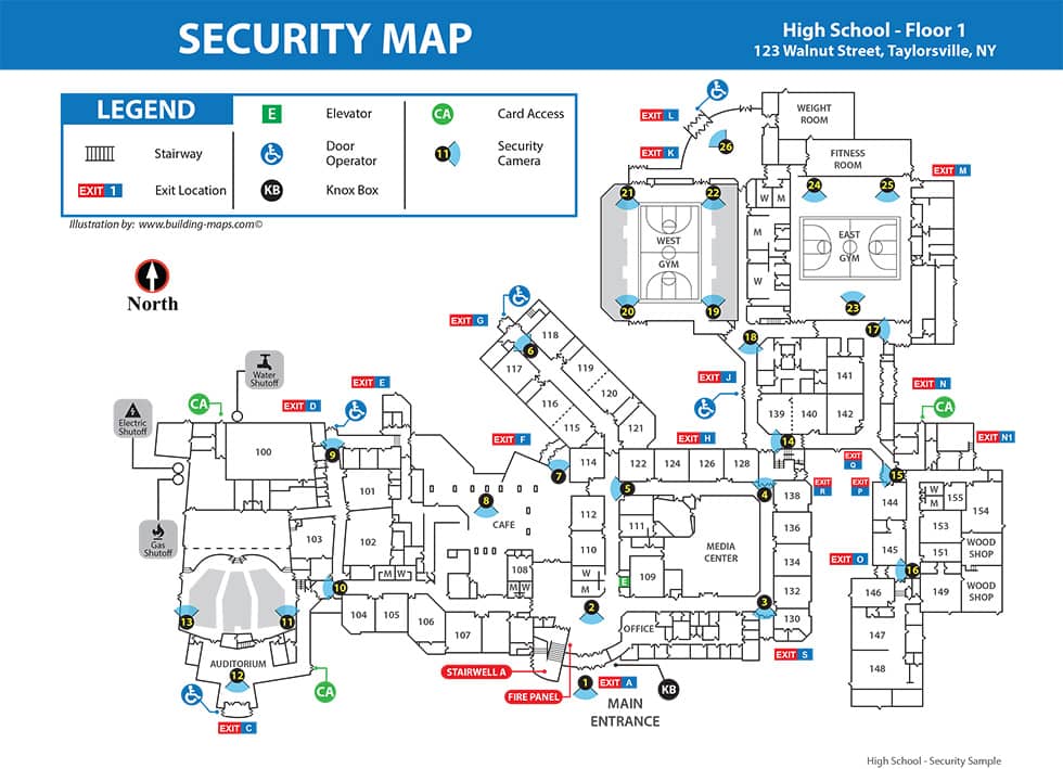
Standard Security Maps
Highly useful for security departments, these maps reflect your building or campus’ security equipment such as camera locations and police pulls.
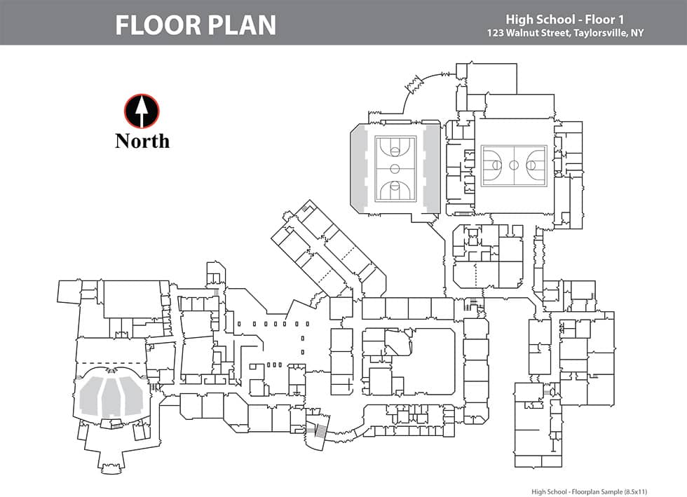
Floor Plans
Our team of trained illustrators will transform your building’s blueprints into a clean and versatile floor plan usable for emergencies. If you don’t have blueprints available, we can digitally scan your building and create up-to-date, highly accurate floor plans.
Critical Incident Maps
Critical Incident Maps typically use satellite imaging to create a realistic depiction of a building and the surrounding area. A grid overlay helps first responders coordinate their efforts and plan more accurately.

