
by Tony Jones | Apr 29, 2025 | Building Maps
What is an Evacuation Assembly Area? An evacuation assembly area is a designated zone where occupants are directed to congregate in the event of an emergency, at a safe distance from the building. Ideally, these evacuation assembly areas are located in open areas such...
by Tony Jones | Sep 25, 2024 | Building Maps
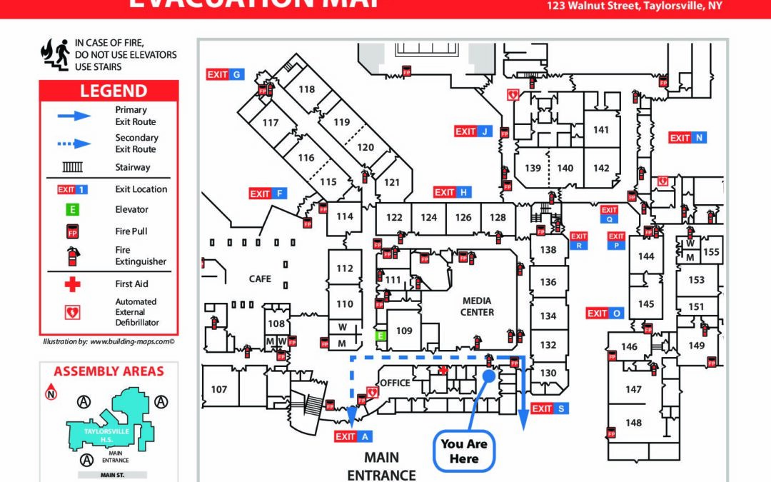
Evacuation maps can be illustrated and posted in a building in a number of ways. Many organizations expect this to be a simple task and try to DIY the illustration and posting of their evacuation maps. However, the people in charge of this task are not always...
by Tony Jones | Mar 26, 2024 | Building Maps
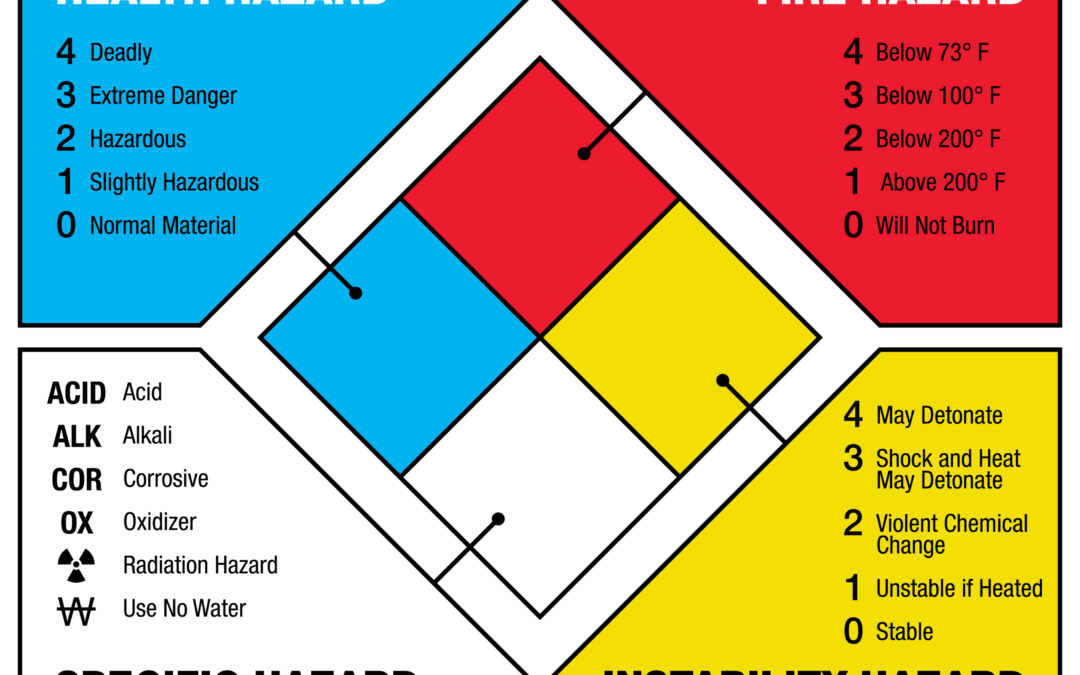
What is NFPA 704 NFPA 704 is also known as the “Standard System for the Identification of the Hazards of Materials for Emergency Response.” This standard provides a widely-recognized system for hazardous material identification. The National Fire Protection...

by Tony Jones | Dec 24, 2020 | Building Maps
What is Pre-Incident Planning? The NFPA defines pre-incident planning as “a document developed by gathering general and detailed data that is used by responding personnel in effectively managing emergencies for the protection of occupants, responding personnel,...

by Tony Jones | Dec 9, 2020 | Building Maps
What is Reverse Evacuation? To put it simply, reverse evacuation plans are put in place for situations when it is safer inside the building than outside of it. Reverse evacuation aims to move all students and staff who are outside of the building into a designated...

Recent Comments