by Tony Jones | Mar 25, 2022 | Building Maps
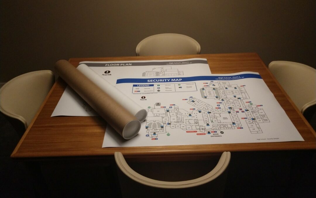
It is generally understood that Campus Maps are used for wayfinding, but oftentimes they are overlooked as an important part of security and emergency planning. The truth is these maps are multi-purpose and can be utilized in a variety of ways. Campus maps typically...

by Tony Jones | Feb 22, 2022 | Building Maps
When it comes to safety, it’s always best to plan ahead. Fire evacuation maps are crucial in this preparation as they depict the primary and secondary egress routes out of buildings. But, knowing where an exit route is located does not guarantee a successful...
by Tony Jones | Jan 21, 2022 | Building Maps
A new year has arrived and with it comes the need to review your emergency planning and update your Emergency Operations Plan. Why Update Your EOP? An Emergency Operations Plan (EOP), also called an Emergency Action Plan (EAP), documents the structures and processes...

by Tony Jones | Dec 20, 2021 | Building Maps
Maps are valuable tools for illustrating where to go and what to do in an emergency. School maps like evacuation maps or campus maps help with pre-incident planning, during an event, and post-event. Reunification maps, in particular, are used after an event to reunite...

by Tony Jones | Nov 22, 2021 | Building Maps
Fire evacuation maps and evacuation plans may sound similar, but they have some key differences. Let’s explore those differences and how each is used for emergency planning. What is a Fire Evacuation Map? A fire evacuation map (sometimes called a diagram) is a...

Recent Comments